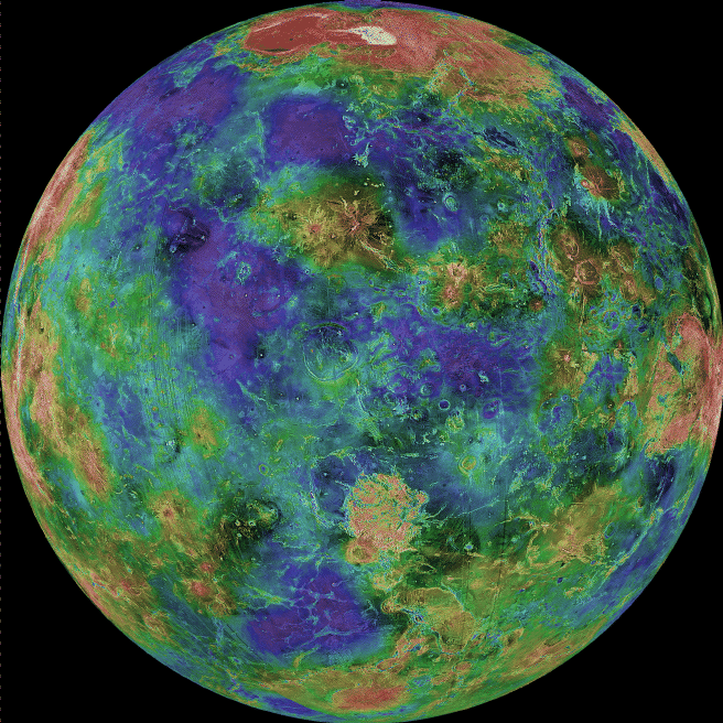
Beneath Venus' Clouds
If the thick clouds covering Venus were removed,
how would the surface appear?
Using an imaging radar technique, the Magellan spacecraft was able to
lift the veil from the Face of Venus and produce this spectacular high resolution image of
the planet's surface.
Red, in this false-color map, represents
mountains, while blue represents valleys.
This 3-kilometer resolution
map is a composite of Magellan images compiled between 1990 and 1994.
Gaps were filled in by the Earth-based
Arecibo Radio Telescope.
The large yellow/red area in the north is
Ishtar Terra featuring Maxwell Montes,
the largest mountain on Venus.
The large highland regions are analogous to continents on Earth.
Scientists are particularly interested in
exploring the geology of
Venus because of its similarity to Earth.


